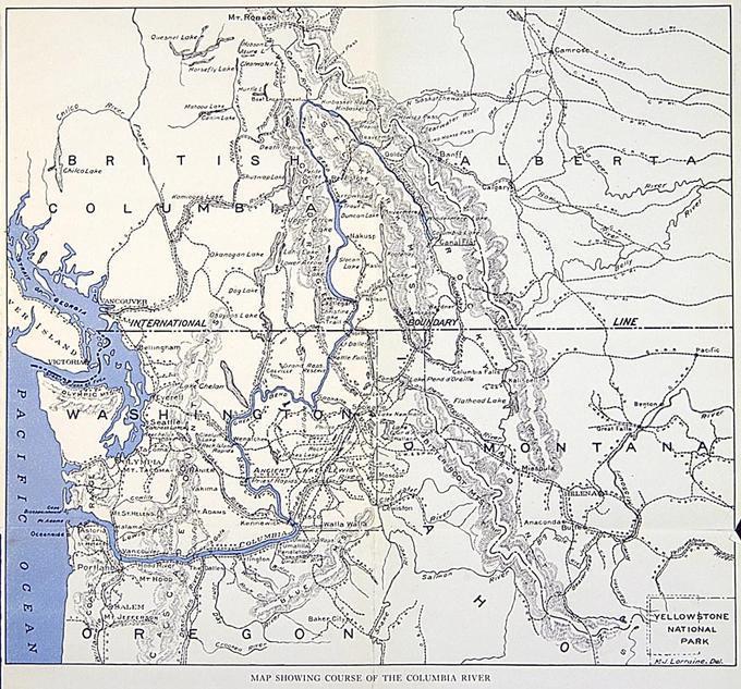
map

- Title
- map
- LC Subject
- Maps Discoveries in geography Discovery and exploration Explorers Rivers
- Creator
- Lorraine, Madison Johnson
- Photographer
- Lorraine, Madison Johnson
- Description
- 446 p. At the age of 68 M. J. Lorraine explored the Columbia River from its source to its mouth alone in a rowboat. He was the second person, after David Thompson in 1811, to make this unbroken voyage in one boat, which he had built himself. The book describes his preparations for the journey and experiences along the way as well as the country through which he travelled, and is illustrated with a number of black-and-white photographs he took en route.
- Inscription
- Map Showing Course of the Columbia River
- Location
- Columbia River >> Clatsop County >> Oregon >> United States Pacific Ocean >> Earth
- Date
- 1924
- Identifier
- ORU_WTXT_025_map
- Rights
- No Copyright - United States
- Type
- Text
- Format
- image/jpeg
- Set
- Western Waters Digital Library
- Is Part Of
- Columbia Unveiled
- Institution
- University of Oregon
- Number Of Pages
- 446 p.
- Image Width
- 875 pixels
- Image Height
- 815 pixels
- Image Resolution
- 125 dpi
- Color Space
- 8 bit - sRGB IEC61966-2.1 - RGB
- File Size
- 294,706 bytes