Irvington Historic District (Portland, Oregon)
- Title
-
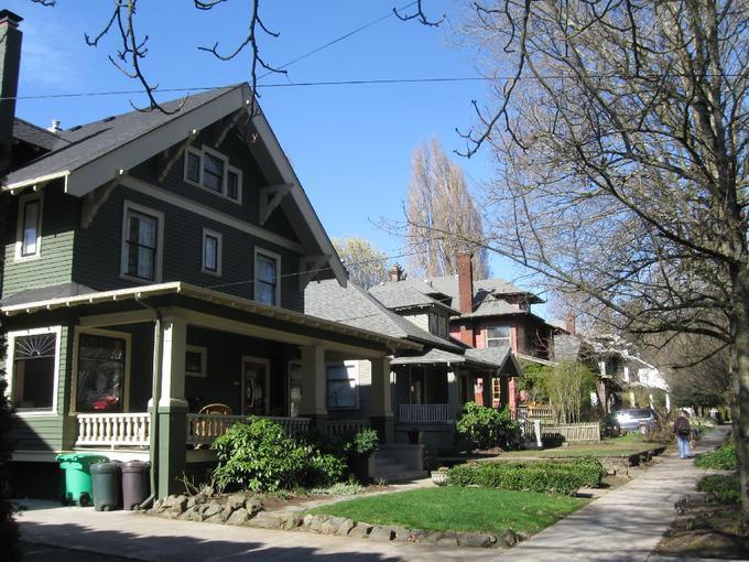
Irvington Historic District (Portland, Oregon)
- LC Subject
-
Architecture, American
Architecture--United States
- Photographer
-
Piper, D. Smith
- Description
-
This image is included in Building Oregon: Architecture of Oregon and the Pacific Northwest, a digital collection which provides documentation about the architectural heritage of the Pacific Northwest.
- View
-
exterior: West side of Northeast 16th Avenue, between Northeast Thompson Street and Northeast Brazee Street, camera facing northwest
- Provenance
-
University of Oregon Libraries
- Style Period
-
Late Victorian
Queen Anne Style
Stick Style
Eastlake
Colonial Revival
Federal
Tudor Revival
Italianate (North American architecture styles )
Renaissance Revival
Craftsman (style)
Prairie School
- Work Type
-
architecture (object genre)
built works
views (visual works)
exterior views
districts
historic districts
dwellings
houses
facilities, commercial
- Location
-
Portland >> Multnomah County >> Oregon >> United States
Multnomah County >> Oregon >> United States
Oregon >> United States
United States
- View Date
-
2009
1900/2000
- Identifier
-
OR_Multnomah_Portland_IrvingtonHD_12.jpg
- Rights
-
In Copyright - Educational Use Permitted
- Rights Holder
-
Oregon State Historic Preservation Office
- Source
-
Oregon State Historic Preservation Office, http://www.oregon.gov/OPRD/HCD/SHPO/
- Type
-
Image
- Format
-
image/jpeg
- Set
-
Building Oregon
- Primary Set
-
Building Oregon
- Is Part Of
-
Irvington Historic District (Portland, Oregon)
- Institution
-
University of Oregon
- Note
-
Opened for development in 1891, the original Irvington Plat and surrounding area is important as an early example of the influence of streetcar development and restrictive covenants in Portland’s residential neighborhoods. These influences had long-lasting impacts on the architectural character of Irvington through 1948 when most lots had been developed and the streetcar lines were replaced with gasoline buses. The extension of streetcar lines from downtown Portland to the suburban eastside of the Willamette River resulted in the use of a strict grid of streets and blocks aligned with the rails and commercial and multi-family development along heavily-traveled routes. To control land uses and guide residential development in this rapidly growing community, developers used privately -imposed and -enforced covenants. Restrictions included minimum street setbacks, establishment of baseline house values, and limits on use, among others. Similar explicit rules were later adopted in other areas, serving as a prelude to the advent of comprehensive land-use planning in early-twentieth century Portland. The district is also notable for the collection of architecturally-important residences constructed between 1891 and 1948. At least 23 prominent architects and builders designed and/or constructed buildings in the district, including Robert Beat, Frederick Bowman, Robert Rice, Edward Mautz, Ellis Lawrence, Joseph Jacobberger, H.L. Camp, Marcus Delahunt, Luther Bailey, and Henry Lambert.
This image was included in the documentation to support a nomination to the National Register of Historic Places, a program of the National Park Service. The image is provided here by the Oregon State Historic Preservation Office and the University of Oregon Libraries to facilitate scholarship, research, and teaching. For other uses, such as publication, contact the State Historic Preservation Office. Please credit the Oregon State Historic Preservation Office when using this image.
