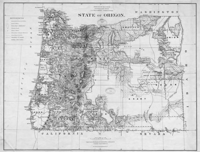
State of Oregon, 1876

- Title
- State of Oregon, 1876
- LC Subject
- Oregon--Maps
- Creator
- Bien, Julius, 1826-1909 Roeser, C. (Charles) United States. General Land Office
- Description
- Compiled from the official records of the General Land Office and other sources by C. Roeser, principal draughtsman. Relief is shown by hachures and gives longitude west from Washington and Greenwich. J.A. Williamson is listed as the Commissioner.
- Work Type
- maps (documents)
- Geobox
- 42.00 -124.75 46.25 -116.50
- Location
- Oregon >> United States
- Date
- 1876
- Identifier
- G4290_1876_U5.jpg
- Rights
- No Copyright - United States
- Use Restrictions
- Acknowledgement of the Oregon State University Libraries' Scanned Maps Collection as a source is requested.
- Source
- Oregon State University Libraries, G4290 1876 .U5
- Type
- Image
- Format
- image/jpeg
- Set
- Oregon Maps
- Primary Set
- Oregon Maps
- Institution
- Oregon State University