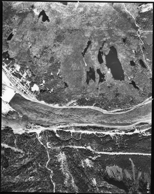
Bonneville Dam: 1939 Aerial Photographs: OCSW 10500 B

- Title
- Bonneville Dam: 1939 Aerial Photographs: OCSW 10500 B
- LC Subject
- Northwest, Pacific Bodies of water Aerial photographs Rivers Dams
- Repository
- University of Oregon. Libraries. Document Center. Map and Aerial Photography Collection
- Description
- Aerial photograph of the Columbia River and surrounding land downstream of the Bonneville Dam. Taken in 1939 as part of the OCSW railroad survey.
- Location
- Oregon >> United States Washington >> United States Columbia River >> Douglas County >> Washington >> United States Bonneville Dam >> Multnomah County >> Oregon >> United States
- Date
- 1939
- Identifier
- ORU_WMAP_001b
- Rights
- No Copyright - United States
- Local Collection Name
- UO Libraries: Map Collection; OCSW
- Type
- Image
- Format
- image/jpeg
- Set
- Western Waters Digital Library
- Is Part Of
- Bonneville Dam: 1939 Aerial Photographs
- Has Version
- Archival TIFF on CD-ROM -- 8647 pixels x 10998 pixels.
- Institution
- University of Oregon
- Image Resolution
- 1200 dpi
- Color Space
- 8 bit - greyscale
- File Size
- 4,120,930 bytes