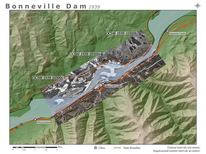
Bonneville Dam: 1939 Aerial Photographs: Guide Map

- Title
- Bonneville Dam: 1939 Aerial Photographs: Guide Map
- LC Subject
- Northwest, Pacific Bodies of water Aerial photographs Rivers Dams Maps
- Repository
- University of Oregon. Libraries. Document Center. Map and Aerial Photography Collection
- Description
- Map showing position of available aerial photographs of the Bonneville Dam area taken in 1939 as part of the OCSW railroad survey. Contemporary terrain, major roads, populated places, and the Columbia River are shown as points of comparison.
- Location
- Oregon >> United States Washington >> United States Columbia River >> Douglas County >> Washington >> United States Bonneville Dam >> Multnomah County >> Oregon >> United States
- Date
- 2004-06-23
- Identifier
- ORU_WMAP_001guide
- Rights
- No Copyright - United States
- Language
- English
- Type
- Image
- Format
- image/jpeg
- Set
- Western Waters Digital Library
- Institution
- University of Oregon
- Image Width
- 1056 pixels
- Image Height
- 768 pixels
- Image Resolution
- 72 dpi
- Color Space
- 24 bit -- RGB -- Untagged
- File Size
- 4,137,604 bytes